Route beta
Direct White Flake — 5.7, 3 pitches, 500'
Bolted friction up black streaks to the classic White Flake traverse — the sane alternative to the runout original. P1 black streak 5.7 → ledge. P2 corner + second streak → belay under the flake. P3 flake traverse left (5.5).
Draws + gear to 4" — bring the #4 Descent: walk off, or rap past Jabberwalky Warm-up + systems rehearsal dayMatthes Crest Traverse S→N — 5.7, Grade IV, ~1 mile of ridge
Gain the ridge from the south end, follow the crest — climbing both sides as needed — over endless exposed fins to the South Summit (crux: strenuous crack below it), then the North Summit. Most parties rope up for the start and the summits, move together in between.
Rack: nuts + cams 0.3–3 + MANY slings Own tat + rings for rap anchors 2.5–3L water each — refill Budd Creek Descent: 2× double-rope raps, west side of N summit onX route ↗ — the traverse, mappedMap & photos
Cathedral Lakes TH → Budd Creek climbers' path → Budd Lake → the crest's south end. ~4 mi, +2,000', 2–3 h in daylight — budget more under headlamp on the blitz.
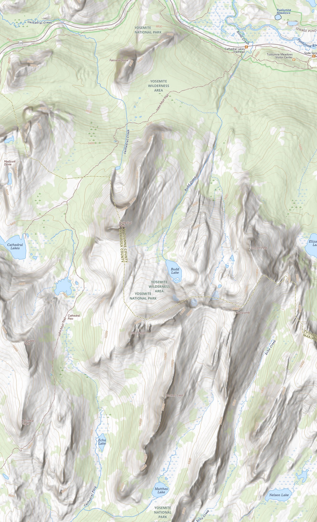
USGS topo (public domain), 40-ft contours, georeferenced overlay. Dashed = the way in: leave the Cathedral Lakes trail ~10 min up, follow Budd Creek to Budd Lake (pass it on the east), over the shoulder south of the lake, then down and along the crest's west base to the south tip. Blue = the traverse, S→N, raps west off the north summit — open the mapped line in onX. Navigate by the terrain, not the line.
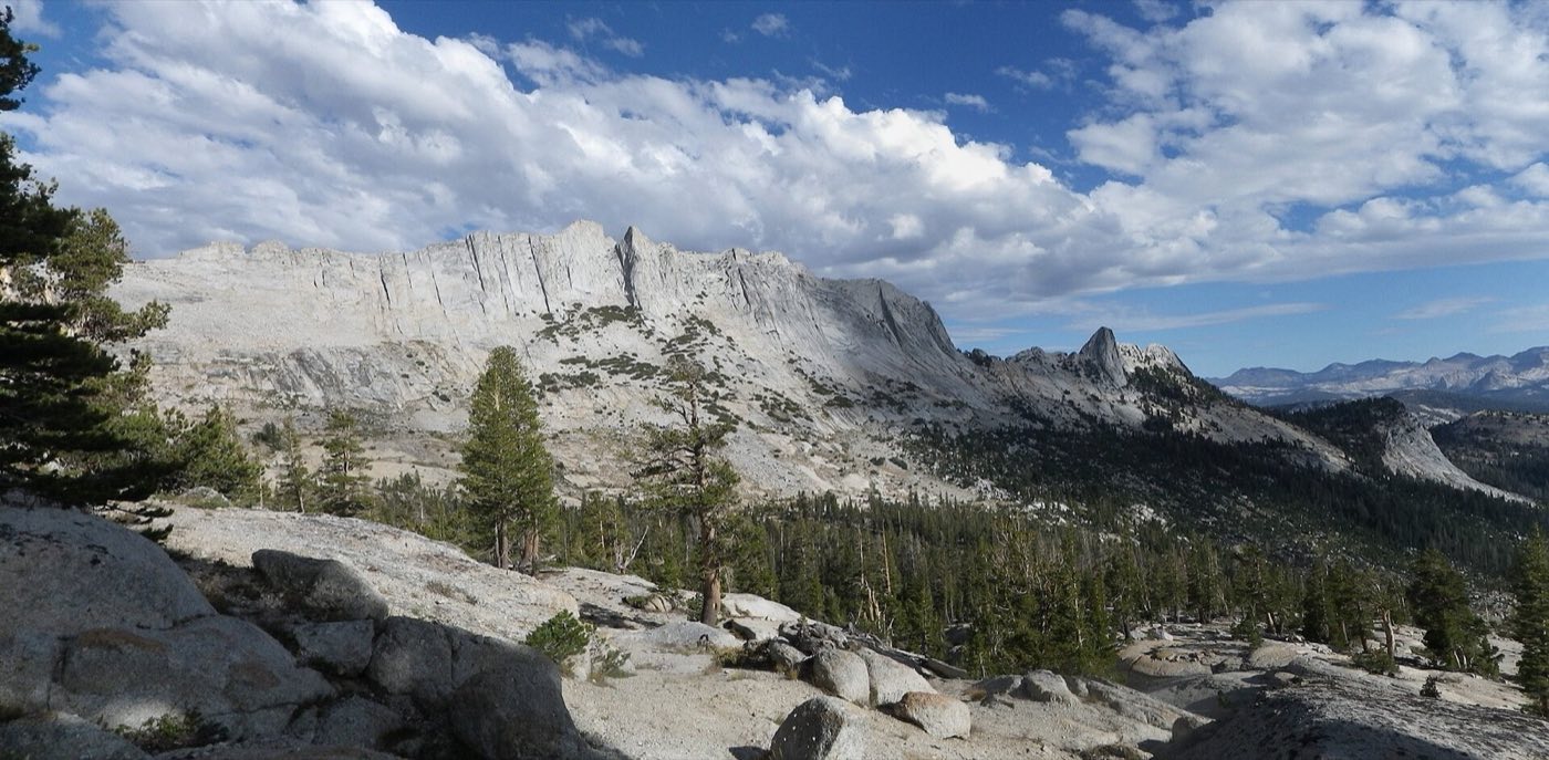
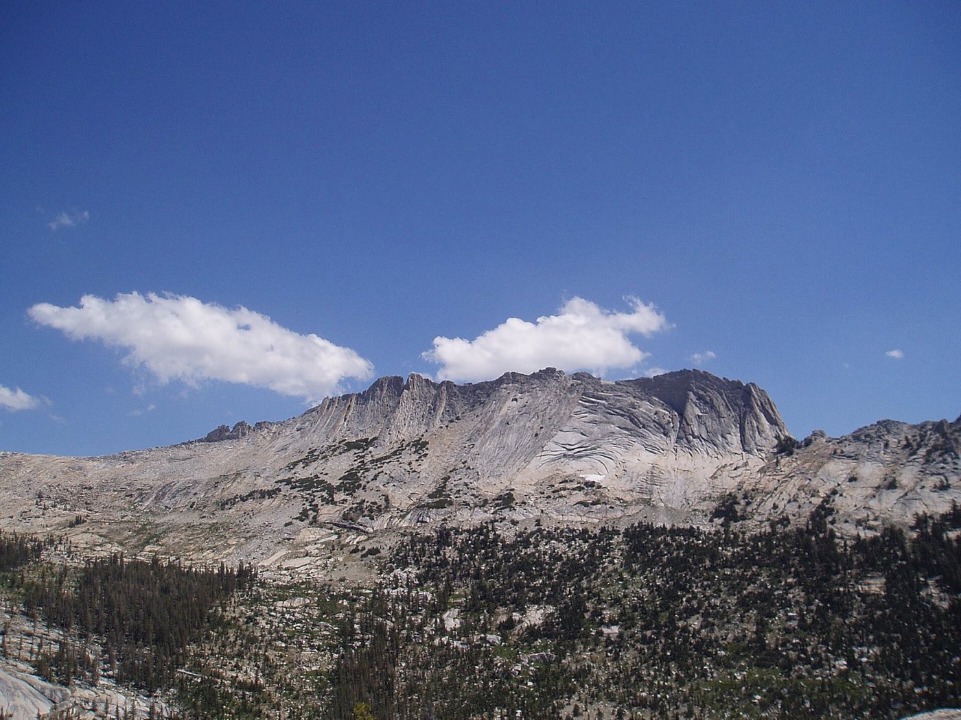
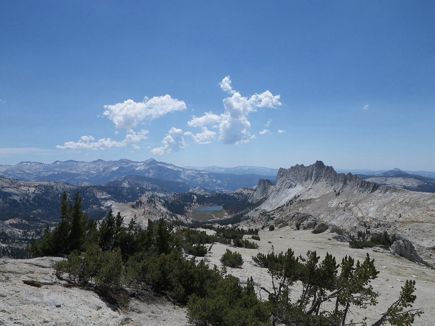
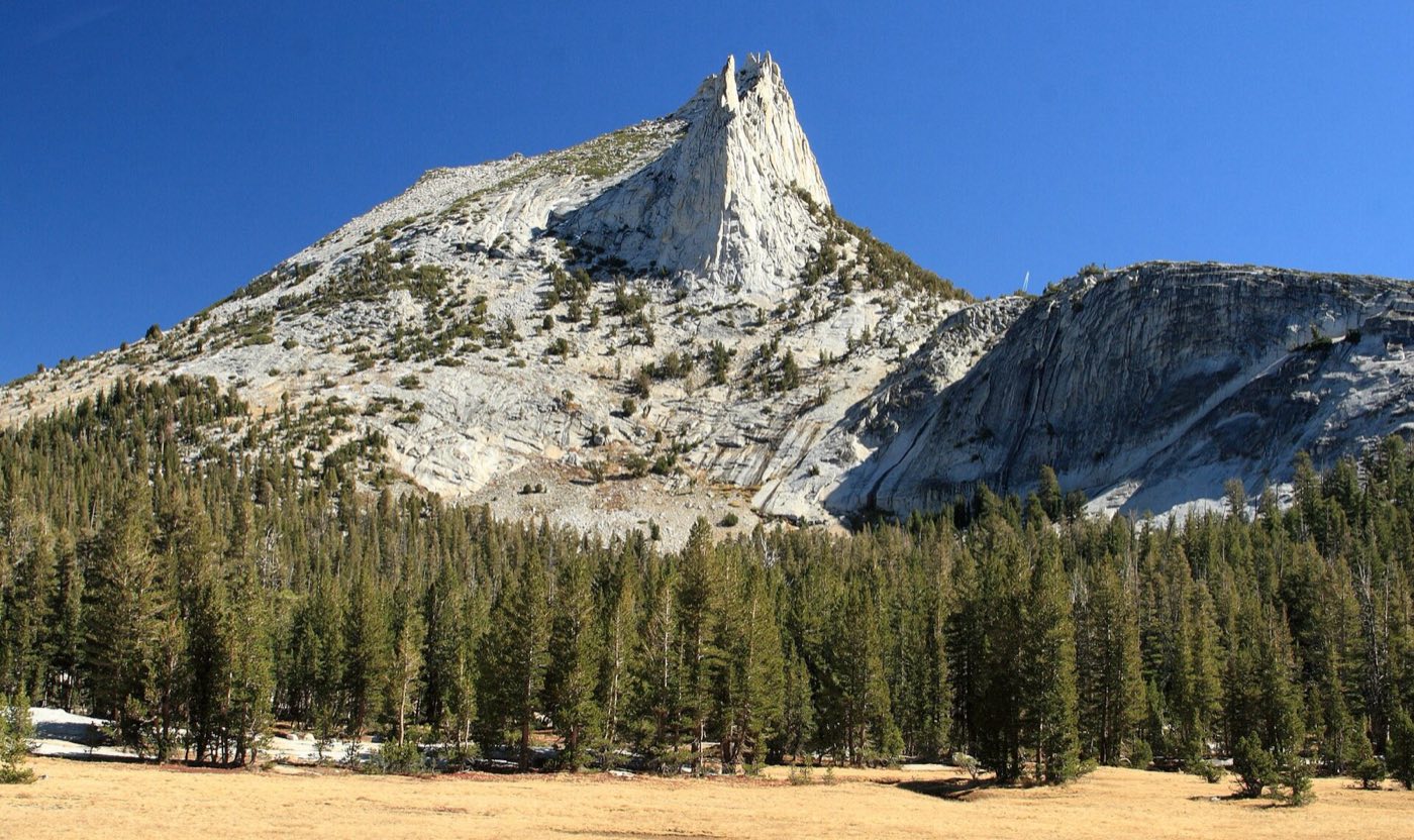
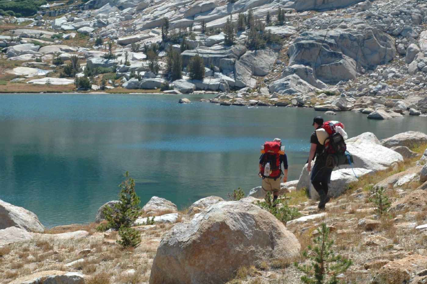
Photos: Lizinvt & Elizabeth George (CC BY-SA 3.0), Semorrison (public domain), Frank Kovalchek & Jay Bergesen (CC BY 2.0) — via Wikimedia Commons. Map: USGS National Map.


Food plan
3 guys · Sat B/L/D, Sun B/L/D, Mon B/L + snack engine. Low added sugar; meat, cheese, nuts do the heavy lifting. Fri dinner = Whoa Nellie Deli.
| Meal | Where | Plan |
|---|---|---|
| Sat bfast | Lee Vining camp | Bagels + PB + cheese, mandarins, coffee. Zero cook — we make the 8:00 meet. |
| Sat lunch | Tenaya Lake | Wraps: salami + cheddar + avocado + mustard. Carrots, apples. |
| Sat dinner | Tuolumne | Dehy pouch each (Peak Refuel) + miso + summer sausage. |
| Sun bfast | Camp, pre-6am | Oats + almond butter + nuts, or dehy skillet. Instant coffee. |
| Sun lunch | On the crest | Pocket food: salami rolls, biltong, cheese, nuts, Epic bar, 85% chocolate. |
| Sun dinner | Back at car | THE FEAST: one-pot pesto penne + parm + sun-dried toms + salami. Pickles. |
| Mon bfast | Camp | Oats + nut butter + leftover cheese, coffee. |
| Mon lunch | Valley | Tuna + olive oil + avo wraps, or Degnan's Deli. |
Safeway — fresh
Safeway — pantry
Blue Moon — natural foods
Math: ~3.5–4k cal/guy on climbing days. Snack pool ≈ 2k cal/day each and IS Sunday's lunch. Pouches ≈ 1k cal + sides. Spare dehy = emergency margin.
Gear
Tuolumne: 8,600–10,900 ft. Warm days, mid-30s°F nights, afternoon storm risk. Checks persist on your phone — everyone ticks their own.
Each guy — climbing
Each guy — camp & clothing
Group — ropes & rack
Group — camp & safety
The Rules
Distilled from the post-mortem doc. We lost a rope, a radio, a knife, a hiking pole, microspikes and a nut tool learning these — they're not up for debate.
The Rappel Ritual — every station, every time
Secure rope to anchor before anything gets tossed → knot both ends → saddle-bag or lap-coil on windy/ledgy terrain instead of throwing → verify which strand pulls and test it before the last man commits → pull the end knots out before pulling the rope → 360° gear check before leaving the station. Both climbers check the setup, out loud.
Two headlamps each. Always.
THE designated headlamp + a backup that lives in the daypack, packed the night before — not found-at-the-trailhead. Spare batteries for both. Fresh set before Matthes.
Timeline + bail gates, decided in advance
Waypoint times written down before we start. South Summit by 13:00 or clouds building = bail west — one 60m rap from the notches per MP. Missing a gate is information, not a challenge. No exposure-soloing to buy back time.
Route homework together, the night before
Everyone reads the topo, the descent, and the bail options at Saturday camp — not on the route. Know how the traverse starts. Printed topos + offline maps on every phone.
Clip it like you mean it
Gear rides on load-rated loops or inside the pack. Radios and knives get leashes. Real climbing packs only — the Cotopaxi stays home.
Systems dialed before the big day
Party-of-3 transitions, simul protocol, knots — rehearsed at Stately on Saturday, sorted before they're needed at 10,800 feet.
Logistics & flags
| Pass | No entrance reservation needed in 2026. James's America the Beautiful annual (bought at Grand Canyon) covers his carload — physical card + photo ID at the gate. A second vehicle needs its own pass or pays $35 (NPS fees). |
| Bears | Canisters required in the backcountry (rent at TM Wilderness Center). Trailhead overnight: food in bear boxes, nothing scented in the car. |
| Storms | Check NOAA point forecast for the Cathedral Range Saturday morning in Lee Vining — last dependable signal. Blue morning ≠ safe afternoon. |
| Signal | None past Tioga entrance. Radios on agreed channel; leave the itinerary with someone at home. InReach if we have one. |
| Gas | Fill at the Mobil in Lee Vining. Nothing dependable in the park high country. |
| Camp Sun | Tuolumne Campground is reservation-only if open (check rec.gov) — fallback is back over the pass to Friday's dispersed spot. |
| Falcons | Peregrine closures run Mar 1–Jul 15 — just ended, but glance at NPS climbing closures to be sure both cliffs are open. |